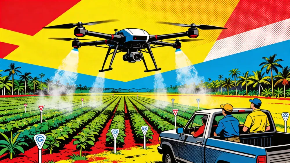
Singapore-based DroneDash Technologies and GEODNET formed GEODASH Aerosystems to develop a farm spraying drone for industrial agriculture, AI News reported. In plain terms: camera vision, centimetre-level RTK, and no mapping lap before the spray run. GEODASH says commercial work could begin in Q3 2026, after field pilots through 2025 and early 2026.
On paper, that is a small workflow change. On a plantation, it is not.
Spray drones already fly over crops. The hard part is getting them to act when rows bend, canopies grow, soil slips, and a field stops matching yesterday's map. GEODASH is betting that the drone can become the map while it works. That puts the new venture in the middle of a farm-equipment fight over who controls the operating layer above the field.
Key Takeaways
- GEODASH targets Q3 2026 for a map-free agricultural spraying drone.
- The system pairs DroneDash AI vision with GEODNET RTK positioning.
- Spray drones still face regulation, battery, drift, and service hurdles.
- The business case depends on faster action across large estates.
AI-generated summary, reviewed by an editor. More on our AI guidelines.
The map becomes the bottleneck
Current spray-drone workflows often start with a survey. A drone or operator maps the block, software generates a route, and a spray aircraft follows the file. When pruning, replanting, erosion, or crop growth changes the field, the route needs work again.
GEODASH says its drone will interpret plantation structure, canopy height, terrain, rows, trees, and operating zones during flight. GEODNET supplies RTK correction data, while DroneDash supplies the vision system and smart-farming backend. The aircraft would adjust altitude and spray rate as conditions change, then log decisions for operator review.
The first markets are telling. GEODASH is aiming at oil palm plantations in Southeast Asia, sugarcane, soybean, and corn operations in the United States, and broad-acre estates in South America. These are not garden plots. They are places where a small delay repeated over thousands of hectares becomes payroll, chemical waste, and missed spray windows.
If you run one of those estates, the clock starts before the drone leaves the truck.
The field is filling with sensors
GEODASH is not entering an empty market. DroneDeploy says its agriculture software is used on 400,000 fields in 130 countries, with tools for stand counts, drainage models, NDVI plant-health layers, management zones, and VRA shapefiles. Pix4D's PIX4Dfields product turns drone and satellite imagery into spot-spraying and variable-rate maps that can move into farm machinery.
That is the existing stack: collect images, process them, export a prescription, then spray. It works. It also leaves a gap between sensing and application.
GEODASH wants to narrow that gap inside the aircraft. The drone still sits inside geofenced boundaries, and the company is not claiming a machine that can roam any farm without supervision. But the direction is clear. The valuable layer is shifting from the map file to the in-flight decision.
Get the farm automation stories that matter
Strategic AI news from San Francisco. No hype, no "AI will change everything" throat clearing. Just what moved, who won, and why it matters. Daily at 6am PST.
No spam. Unsubscribe anytime.
Farm managers may like that. Regulators may be more anxious.
Spraying still runs into law and physics
Ohio State University Extension's drone-spraying fact sheet makes the limits plain. Spray drones can help when wet soil blocks heavy sprayers, when fields are small or irregular, or when farmers want to reduce applicator exposure. But they also cover fewer acres per hour than ground sprayers or piloted aircraft, and batteries may last only 5 to 15 minutes with a full tank.
The U.S. rulebook adds drag. Commercial spray-drone operators need FAA flight authority and aerial application authority, plus state pesticide credentials where required. Then comes the label. Ohio State says U.S. pesticide labels still do not spell out drone-specific spray instructions. EPA allows drone use when the product already permits aerial application and the operator follows FAA rules.
The aircraft can outrun the form. That's the rub.
Technical design is unsettled too. Nozzles matter. Swath width matters too. So do flight height, wind, and droplet size. The ugly question is whether the spray punches into the canopy or floats past it. RTK and AI vision help locate the aircraft and read the crop. They do not repeal drift.
The economics are pulling younger operators in
The adoption pressure is not only coming from large estates. At the Canadian Agricultural Drone Association conference in Alberta, Auburn University researcher Steve Li said agricultural drones give young people a lower-cost entry into farm services. The Western Producer's price comparison was blunt. A traditional sprayer can run $750,000 or more; an entry-level drone can sit near $50,000.
Agri Spray Drones made a similar pitch when it announced a Canada expansion this month. Labour is thin. Acreage is huge. Some ground stays hard to reach, and spray windows shut fast. Canada is still working through drone pesticide rules, but the commercial interest is already there.
This is where GEODASH's timing matters. If operators can move from mapping jobs to application jobs faster, one crew can cover more ground. If each flight also feeds canopy density, plant health, spray-effectiveness, and terrain data into a backend, the drone becomes a field notebook with rotors.
Not magic. A notebook.
The next farm platform may fly low
The larger story is not that drones can spray crops. Japan, South Korea, and China have proved that for years, and Ohio State says China used more than 120,000 crop-protection drones in 2021. The larger story is that farm drones are being asked to collapse sensing, planning, application, and recordkeeping into one pass.
GEODASH has not yet proved it can do that at commercial scale. The company says its Q3 target still depends on manufacturing readiness and regulatory approvals. Farmers will ask rougher questions. Acres per hour. Uptime. Chemical labels. Service support. Whether the spray pattern holds when the wind picks up.
But the absence matters as much as the presence. A map-free spraying drone would not remove agronomists, applicators, or compliance officers from the field. It would remove one more pause between seeing a crop problem and acting on it.
On a 5,000-hectare estate, the pause is the machine.
Frequently Asked Questions
What is GEODASH Aerosystems building?
GEODASH Aerosystems is developing an agricultural spraying drone for large farms and plantations. The system is designed to use AI vision and RTK positioning so it can spray without a separate pre-mapping flight.
When is GEODASH targeting commercial deployment?
GEODASH is targeting commercial deployment in Q3 2026, after pilot deployments and validation projects that the companies say ran through 2025 and early 2026.
Why does map-free spraying matter?
Large farms lose time when fields must be mapped before each spray run. If a drone can read rows, canopy height, terrain, and zones during flight, operators may act faster when crop conditions change.
What could slow adoption of spray drones?
Regulation, pesticide labels, battery life, acres covered per hour, drift control, service support, and spray quality can all slow adoption. Smarter navigation does not remove those constraints.
Who is the first target market?
GEODASH is initially targeting oil palm plantations in Southeast Asia, row-crop operators in the United States, and large estates in South America.
AI-generated summary, reviewed by an editor. More on our AI guidelines.


Marcus Schuler
Editor-in-Chief and founder of Implicator.ai. Former ARD correspondent and senior broadcast journalist with 10+ years covering tech. Writes daily briefings on policy and market developments. Based in San Francisco. E-mail: editor@implicator.ai